

Project WHOTS - WHOI Hawaii Ocean Time-series Station
| Sponsors | ||
| ||

| Data Links | |
| WHOTS-21 Deployed: September 24, 2025 at 00:53 UTC Met data text files: Daily transmission: Logger 5 Logger 42 Complete listing: Logger 5 Logger 42 Plots: plot-1 or plot-2 or plot-3 | |
| WHOTS-20 Deployed: June 2, 2024 at 03:47 UTC Met data text files: Daily transmission: Logger 3 Logger 8 Complete listing: Logger 3 Logger 8 Plots: plot-1 or plot-2 or plot-3 |
| See Also |
| Archived WHOTS data |
| WHOTS at UH |
| WHOTS data at NDBC Station 51WH0 |
Real Time Data
The WHOTS site is WMO station 58400 (formerly 51400), and is NDBC Partner Platform 51WH0.
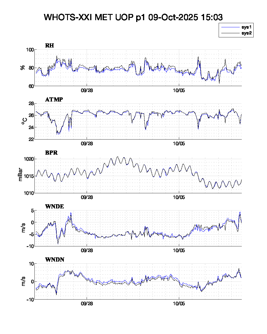
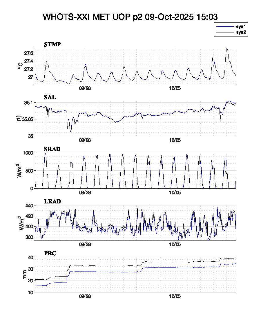
Hourly averaged meteorological data for the current deployment of the WHOI Hawaii Ocean Time Series Station are received via Service Argos four times daily and via Iridium transmissions hourly. Preliminary data is displayed in unedited form as time series plots, and is available for download as ASCII files.
Please see the data archive page for edited, post-recovery data from earlier deployments of this buoy.
A note on resolution, and one on ASIMet data formats.
WHOTS 21
The WHOTS 21 buoy was deployed from the R/V Sette on September 24, 2025 at 00:53 UTC at approximately 22° 46´ N 158° W. The buoy is equipped with two complete systems of ASIMET sensors which transmit data hourly via Iridium telemetry (Iridium resolution).
 |
 |
Last updated: 2025/09/30